Key Takeaways
Drone monitoring is most useful when each capture is planned around a clear project question. Consistent imagery, safe operations and well-defined outputs help you turn aerial views into reliable records.
- Set capture timing around project milestones and decisions.
- Use repeatable flight plans and suitable survey controls when measurements matter.
- Treat imagery as a record to review alongside site inspections and project information.
- Check CASA requirements and coordinate flights with site safety procedures.
- Agree on deliverables, accuracy needs, data handling and turnaround times before work begins.
How drone progress monitoring works on Australian construction sites
Construction drone progress monitoring Australia projects can use begins with a practical question: what needs to be visible, measured or recorded? A repeatable capture provides a snapshot of site conditions that teams can compare with earlier imagery, plans and programme milestones. It supports project communication, but it does not replace site inspections or professional judgement.
Capture repeatable aerial imagery and data
A monitoring flight is planned to capture the same areas and useful viewpoints at agreed intervals. Consistency makes it easier to see what has changed, rather than mistaking a different angle or extent for real progress. You can document access routes, work zones and visible activity while keeping the capture plan aligned with site conditions and safety controls.
Compare site conditions with plans and schedules
An aerial record becomes more useful when you review it against a specific reference, such as a drawing, milestone or earlier capture. That comparison can help your team identify areas that need a closer look and frame questions for the next site review. Keep the distinction clear between a visual update and measured progress; measurement requires a suitable method and validation for the decision at hand.
| Project question | Useful comparison | What it can help you review |
|---|---|---|
| Has the work area changed? | Current and previous imagery | Visible site changes |
| Is a milestone evident? | Capture and programme milestone | Whether visible work aligns with the planned stage |
| Does an area need follow-up? | Aerial view and site inspection | Questions for the project team |
The table is a prompt for review, not a substitute for project controls. You can use consistent aerial captures to identify where a closer inspection, survey or schedule discussion may be needed. For additional context, this guide to drone construction surveys discusses aerial mapping and progress tracking.
Share findings with project teams and stakeholders
A clear record is easier to act on when people know its capture date, coverage and purpose. Share imagery with a short note about what changed and which areas need attention, rather than relying on a wide view to tell the whole story. Construction Time Lapse Specialists provides visual monitoring services that include drone imaging and high-resolution photography, alongside time lapse camera solutions, with secure remote portal access for viewing site progress.
What drones can measure and document
Drone outputs can range from straightforward aerial photographs to processed mapping and models, depending on the capture method and project requirements. The right deliverable depends on whether you need a visual record, a spatial reference or a quantity estimate. Define that need before selecting a method, and confirm how results will be checked before they guide a decision.

Track earthworks, stockpiles, and site access
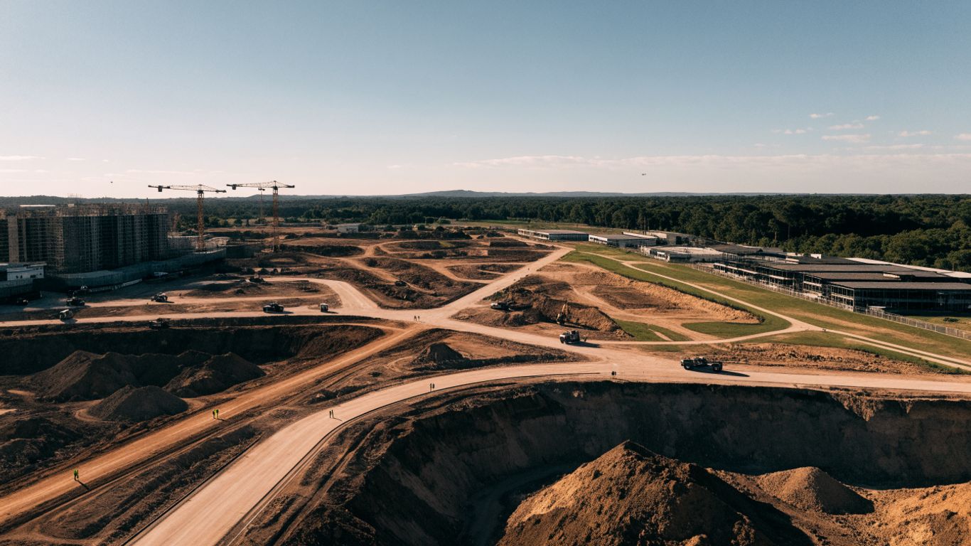
Repeated aerial views can document visible changes to earthworks, stockpile areas and site access. Where a quantity is required, the survey approach and reference data need to be appropriate to the calculation; a photograph alone does not establish a verified volume. Keep the capture dates and any assumptions with the result so the team can understand what the comparison does and does not show.
Review structural progress and installed components
Aerial imagery can give you a broad view of visible structural work and installed components, especially across areas that are difficult to see from a single ground position. It may help locate a section for closer review, but it cannot confirm concealed work or replace required inspection and sign-off. Use it as one record among the drawings, inspection notes and other project evidence.
Create orthomosaics, 3D models, and progress reports
Depending on the capture and processing workflow, drone data may be used to create orthomosaics, 3D models and progress reports. The deliverable should be named precisely, with its date, coverage and intended use clear to the people receiving it. For a broader view of construction drone progress monitoring, compare the types of capture and review process with your project’s needs.
How to plan a reliable monitoring workflow
A reliable workflow starts with the decisions your team needs to make, then works back to the capture and delivery plan. Set responsibilities for flight coordination, review and distribution before the first scheduled visit. Construction Time Lapse Specialists combines time lapse camera solutions with drone imaging and high-resolution photography as visual monitoring services for construction projects.
Set capture frequency around project milestones
Choose a schedule that reflects the pace of work and the value of seeing change at that point in the programme. A regular cycle may suit a long project, while extra captures can be useful around significant milestones or changing site conditions. Keep the schedule practical: each capture should have a clear audience and a reason to be reviewed.
Define flight paths, ground control, and image overlap
Repeatability depends on planning coverage, viewpoints and any survey controls required for the output. Confirm the capture area, image overlap and ground control approach with the person responsible for processing or surveying, especially when measurements will inform decisions. Before mobilising, make sure the plan fits the site layout, access restrictions and operating conditions.
A short pre-flight plan can keep the team aligned on the basics:
- Confirm the areas and viewpoints to capture.
- Check site access, inductions and any restricted zones.
- Agree on ground control and validation needs for measured outputs.
- Set image delivery, review responsibilities and file naming.
These steps make it easier to repeat the process and interpret each new record. They also help you identify changes to the plan before a scheduled capture, rather than discovering them after the flight.
Align outputs with project software and reporting needs
Decide how the team will receive and review the outputs before capture begins. Agree on file formats, naming, access permissions and how each record will be referenced in project reporting. Construction Time Lapse Specialists offers secure remote portal access for viewing site progress; confirm that any proposed workflow fits your team’s information and reporting requirements.
Australian regulations and site safety considerations
A flight over a construction site needs to be planned as an aviation activity and as part of the site’s work environment. Requirements depend on the operation, location and circumstances, so check the current rules rather than relying on a generic checklist. Build coordination with site management into the plan, including who can pause or change a flight if conditions shift.

Check CASA rules for the planned drone operation
Check the Civil Aviation Safety Authority (CASA) requirements that apply to the planned operation, including any relevant operator, pilot, airspace and flight conditions. Do this before confirming dates, and check whether approvals or other arrangements are needed for the specific location and operation. A project’s internal permission to access the site does not by itself establish that a flight can proceed under aviation rules.
Coordinate flights with site inductions and safety procedures
Coordinate the capture with the site manager so the flight fits inductions, exclusion areas, active lifts, plant movements and other changing hazards. Agree on the launch and recovery area, communication method and stop-work process before the aircraft is brought onto site. For more background, use this Australian drone compliance guide as a starting point, then verify the requirements for your operation.
Protect worker privacy and manage captured data responsibly
Images may include workers, neighbouring properties or other details that are not necessary for the project record. Limit capture and access to what the monitoring purpose requires, and set clear retention and sharing practices with your team. Keep unrelated reference material—such as bridal accessories, digital mental health platforms, camping preparation, privacy information or forex trading—separate from construction project records.
How to evaluate accuracy, costs, and limitations
The best method depends on the consequence of getting a decision wrong and the level of detail needed. A visual comparison may be enough for a progress conversation, while quantities or survey decisions call for appropriate controls and validation. Consider the capture, processing, review and coordination effort together, not just the time spent in the air.
Match survey methods to the decisions being made
Start by stating what the output will be used to decide. Visual records can help you review visible change; measured outputs need a suitable survey method, reference and quality checks for their intended use. Ask who is responsible for validation and whether the output’s accuracy is appropriate for the decision, rather than assuming that a detailed-looking model is automatically survey-grade.
Account for weather, obstructions, and site conditions
Wind, rain, changing light, dust, cranes, temporary structures and restricted areas can affect whether a planned capture is safe or useful. A flight may need to be postponed or adjusted, and an obstructed view may leave gaps in the record. Keep a note of relevant conditions so reviewers understand why coverage or appearance differs between visits.
Treat each capture as a dated observation made under particular conditions. That makes comparisons more honest and helps your team decide whether another view, a ground inspection or a different method is needed. For a related perspective on drone construction photography, consider how visual updates can support progress communication without standing in for measured evidence.
Compare setup costs with time and rework savings
Compare the full cost of a monitoring cycle with the practical value it may offer your project: timely visibility, a usable record and fewer delays in finding information. Include planning, travel, processing, review and storage in the comparison, and avoid treating potential time or rework savings as guaranteed. A small trial on a representative area can help you judge whether the output is worth repeating.
How to choose a drone monitoring provider
A suitable provider should understand both the requested output and the conditions of an active construction site. Ask how the capture will be planned, what checks will be applied and who will interpret the results. Make responsibilities, safety arrangements and data handling explicit before you agree on a schedule.
Check construction experience and survey qualifications
Ask for examples of work on projects with similar access, scale or reporting needs, and clarify the team’s role in capture, processing and interpretation. If you need measured survey information, check the relevant qualifications and who accepts responsibility for the method and validation. Construction experience matters, but it should be supported by a clear explanation of how the deliverable meets your purpose.
Confirm data formats, turnaround times, and ownership
Agree on file formats, delivery timing, storage, access and ownership of the captured material. Confirm whether revisions or additional processing are included, and how the provider will communicate when weather or site conditions change the schedule. If your project uses a specific reporting process, test that the proposed handover can fit it before routine captures begin.
Request sample deliverables and define success measures
Review a sample that resembles the output you expect, then agree on what a successful monitoring cycle means for your team. It might be timely delivery, consistent coverage or clear documentation of a specified milestone; choose measures you can actually review. Construction Time Lapse Specialists provides visual monitoring services including drone imaging, high-resolution photography and time lapse camera solutions, so ask for details of the deliverables relevant to your project.
Conclusion
Drone monitoring works best when you know what you need to see, how the information will be checked and who will use it. Plan captures around project decisions, coordinate them with site and aviation requirements, and treat each output as evidence with a defined purpose and limitations.
Frequently Asked Questions
What is construction drone progress monitoring?
It is the planned capture and review of aerial imagery or data to document site conditions and changes over time. Depending on the method, outputs can support visual reviews or measured work, with appropriate validation for the intended use.
How often should a construction site be captured?
Set the schedule around project milestones, the pace of work and the decisions that depend on updated information. Regular captures can support comparison, while extra flights may be appropriate for significant milestones if the operation can be planned safely.
Can drone imagery verify construction progress?
Imagery can document visible conditions and help a team compare them with prior records or plans. It does not confirm concealed work, and measurement or verification requires a suitable method and review by the responsible professionals.
Do drone surveys replace traditional site surveys?
No. Aerial data may complement other survey methods, inspections and project records, but it does not automatically replace them. Choose the method according to the decision, required accuracy and professional responsibilities involved.
What affects the accuracy of drone data?
The capture method, ground control, processing, site conditions and validation all affect the result. Weather, obstructions and changes in coverage can also limit comparisons, so record relevant conditions and confirm accuracy for the intended use.
What should you check before a drone flight on a construction site?
Check the CASA requirements for the planned operation and coordinate site access, inductions, hazards, restricted areas and communication with site management. The flight should be rescheduled or changed if conditions make it unsuitable.
How should construction drone imagery be shared?
Agree on file formats, access, naming, retention and ownership before routine capture starts. Share records with enough context—such as capture date, coverage and purpose—for project stakeholders to interpret them responsibly.