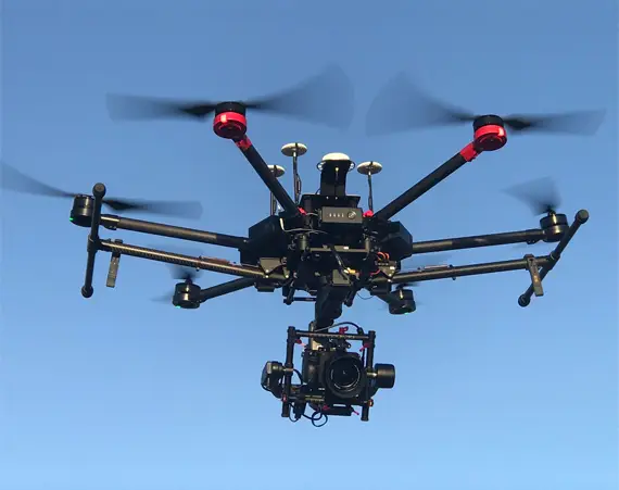
Drone Aerial Photography
Monthly Reporting: Improve Progress Tracking with Visual Content
Using drone photography for monthly reporting enhances your project updates with clear, engaging visuals. By combining aerial images, drone video, and time-lapse footage, you can give stakeholders a complete and professional view of your project’s progress.
Why Use Drone Photography for Monthly Reporting?
Drone imagery and time-lapse footage help project managers, stakeholders, and investors stay informed. These tools turn traditional reports into dynamic visual updates that are easier to understand and more engaging.
Benefits of Drone Photography, Video, and Time-Lapse
1. Complete Project Documentation
Capture high-resolution aerial images of the entire site.
Show long-term progress with time-lapse video.
Use drone video to highlight specific construction stages.
2. Better Communication with Stakeholders
Add engaging visuals to every monthly report.
Make updates clear for clients, teams, and investors.
Use professional content to showcase important milestones.
3. Improved Site Monitoring and Safety
Monitor construction activity from the air.
Identify problems early with regular aerial inspections.
Track safety compliance by reviewing drone footage.
Industries That Benefit from Drone Reporting
Drone photography for monthly reporting works across many sectors:
Construction
Monitor commercial and industrial building projects.
Civil Works
Track progress on bridges, roads, and infrastructure developments.
Residential Projects
Document home construction and housing estates.
Make Your Reports More Effective
When you add drone photography for monthly reporting, you improve clarity, increase engagement, and make data-driven decisions easier. With aerial images and time-lapse videos, your reports become powerful tools for communication and project management.
Construction progress reporting
Droneworxs Unique Inspection Services
Designed for Hard-to-Reach & Hazardous Areas
Ideal for inspecting difficult-to-access assets and structures.
Reduces the need for risky manual inspections.
Non-Disruptive Operations
Inspections cause no interference with ongoing site activities.
Requires only a few square meters for launch and retrieval.
Often operates from the perimeter of customer sites.
Precision-Controlled Drone Technology
Lightweight, remotely piloted aircraft for safe, efficient inspections.
Capable of close-up inspections without compromising property or safety.
Provides high-resolution visuals for detailed assessments.
Real Estate photography
Droneworxs Aerial Videography & Photography for Real Estate
The New Standard in High-End Marketing
Elevate property listings with stunning aerial imagery.
Offer 360° exterior tours for an immersive viewing experience.
Seamless Promotional Packages
Professionally crafted visuals to set listings apart from the competition.
Customizable content to suit different property types and marketing needs.
Efficient & Safe Operations
Adheres to strict safety protocols for risk-free aerial shoots.
Ensures projects stay on-time and within budget.
360 Panoramas for renders
Unrestricted Interactive Aerial Views with Droneworxs
Cutting-Edge Technology
Combines drone, camera, and internet technologies for immersive aerial views.
Provides a fully interactive 360° x 180° experience of any location.
Multiple Viewing Options
View on a computer for easy access.
Hosted online for seamless sharing and website embedding.
Full-Range Perspective
Capture a 360° panoramic view at any altitude under 120 meters.
Enjoy a 180° vertical view, looking straight up, down, or anywhere in between.
Asset Inspections
Droneworxs Unique Asset & Plant Inspection Services
Specialized for Hazardous & Hard-to-Reach Areas
Designed to inspect assets and structures in difficult-to-access or hazardous locations.
Non-Disruptive to Operations
Inspections cause no disruption to ongoing site activities.
Requires only a small area (a few square meters) for drone launch and retrieval.
Often works from the perimeter of customer sites, minimizing disruption.
Precision-Controlled, Lightweight Aircraft
Remote piloted aircraft that is precision-controlled for accurate inspections.
Lightweight construction allows for close-up inspections without risking property damage.
Operates safely around assets and structures, ensuring the safety of both property and personnel.
Our Drone
Brisbane’s Leading Drone Aerial Photography Services Have you been searching for the best in the business to take photos and/or video from above? Droneworxs Aerial Photography is Brisbane’s go-to fully licensed commercial Drone aerial photography and video specialist, and for very good reason. We’re backed by an extensive amount of experience with clients in many different industries, from asset inspection, mapping and surveying to sporting events and everything in between, and have built up a reputation for delivering nothing but outstanding shots time and time again.

OUR WORK
Tracking project milestones, assessing contractor progress, Managing your project and communicating with your team. Document each step of your construction project.
TALK TO US.
For a free site consultation where we can discuss your project, scout the location and determine a solution which matches your objectives, then talk to us.