
Key Takeaways
Good construction drone photography starts with a clear purpose and ends with imagery that people can use.
- Define the decisions and deliverables the imagery must support.
- Plan repeatable flights, safe access and suitable camera equipment.
- Follow CASA requirements and integrate each flight with site safety controls.
- Combine aerial views with ground photography and time-lapse records where useful.
- Store, share and review imagery so it remains valuable throughout the project.
Understanding the value of construction drone photography
Construction drone photography gives project teams a broad, repeatable view of changing site conditions. Used well, it complements drawings, site walks, reports and other visual records rather than replacing them. The value is not simply the height of the camera; it is the ability to create clear evidence that can be reviewed by people who were not on site. For a wider introduction to the subject, construction drone photography benefits covers how aerial imagery can support assessment, management and marketing.
Tracking progress across every project stage
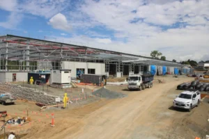
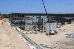
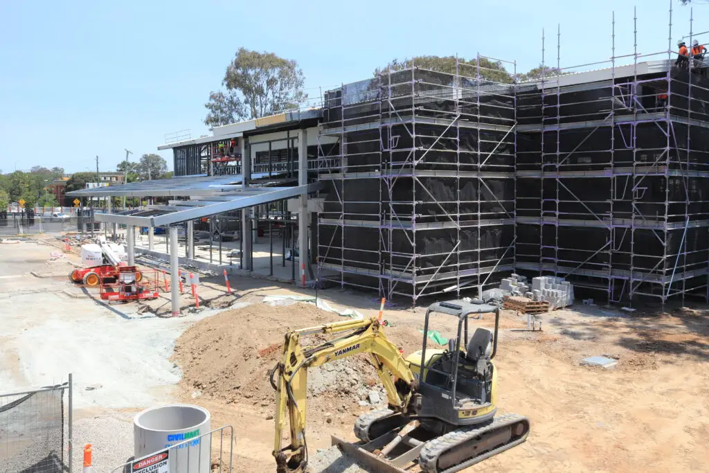
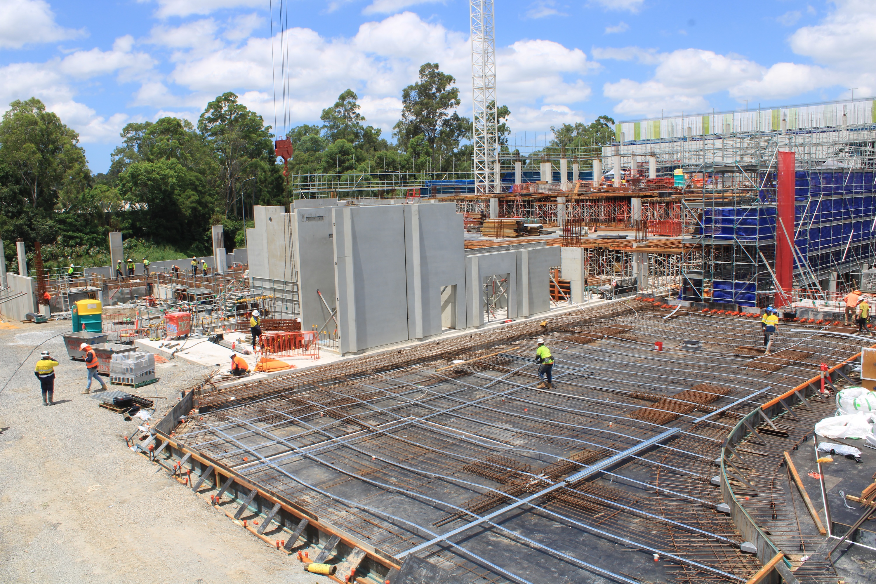
A planned flight programme can record the site before work starts, during earthworks and structure, and through fit-out and completion. Wide views show sequencing, access routes, laydown areas and the relationship between separate work fronts. Closer images can help confirm visible milestones, although they should be read alongside project records and professional inspections. The most useful archive is chronological, consistently framed and labelled with the date, location and stage of work.
Improving communication with clients and stakeholders
Aerial imagery gives clients, consultants, investors and government stakeholders a common visual reference for progress discussions. A single image can explain site context more quickly than several paragraphs, particularly when work is spread across a large or difficult-to-access area. It can also support remote meetings when participants cannot attend a site walk. The image should still be accompanied by a short explanation of what has changed, what remains outstanding and what the viewer should look at.
Supporting documentation, marketing and dispute resolution
Images captured at agreed intervals create a useful visual record of site conditions, temporary works and completed stages. They may support progress reports, tender material, project case studies and discussions about when a visible change occurred. They are not, by themselves, a substitute for contracts, inspections or legal advice. Good metadata, secure storage and an unambiguous chain of custody make the record more credible when questions arise later.
Comparing drone imagery with traditional site photography
Drone and ground photography answer different questions. A ground camera is better for finishes, workmanship and close detail, while an aerial view explains scale, layout and relationships across the site. Time-lapse adds a consistent record from a fixed position, showing change between intervals. A combined approach avoids asking one viewpoint to do every job.
| Visual method | Best used for | Main strength |
|---|---|---|
| Drone imagery | Site layout and broad progress | Context across a large area |
| Ground photography | Finishes, details and workmanship | Close, human-level evidence |
| Time-lapse cameras | Change over a long period | Consistent repeatable viewpoint |
The choice should follow the reporting question, not the novelty of the equipment. Construction Time Lapse Specialists combines time-lapse cameras, drone imaging and high-resolution photography to create visual monitoring from multiple perspectives.
Planning a successful construction drone shoot
A productive shoot is decided before the aircraft leaves the ground. The team needs to know what the images are for, how often they are required and who will use them. Planning also covers weather, access, people, plant, temporary works and the condition of the site on the day. A modest flight plan carried out consistently is usually more useful than an ambitious plan that cannot be repeated safely.
Defining project goals and required deliverables
Start with the decision the imagery must support. A monthly progress report may need fixed overview images, while a marketing package may call for smooth movement and selected hero frames. Mapping requires different overlap, control and processing requirements from a simple photographic record. Write down the required outputs, image orientation, resolution, file type, delivery date and any restrictions on showing workers, neighbours or sensitive infrastructure.
Choosing the right flight frequency and coverage
Frequency should reflect the speed of change and the cost of missing a milestone. Active earthworks may justify more frequent coverage than a stable period of internal fit-out. Define the boundary of each flight, including neighbouring areas that provide context, and keep the same core viewpoints from visit to visit. A short additional flight after a major pour, installation or site change can be more valuable than increasing every routine visit.
Identifying site conditions, access points and hazards
Review the site plan before arrival and confirm where the pilot, observer, vehicle and equipment can safely stand. Consider cranes, suspended loads, powerlines, scaffolding, dust, water, public roads, changing exclusion zones and radio or navigation interference. The plan should identify an emergency landing area and a clear method for stopping the operation if conditions change. A site map marked with launch, recovery and no-fly areas makes the briefing easier for everyone.
Coordinating with site managers and contractors
The site manager should know the proposed date, duration, operating area and controls before the flight is booked. Coordinate with crane crews, traffic controllers, subcontractors and anyone responsible for lifting or high-risk work. On the day, confirm the site is in the expected condition and that workers understand the exclusion zone. A simple pre-start conversation prevents the pilot from discovering that the planned flight conflicts with a delivery or critical lift.
For routine programmes, keep a written record of:
- The approved flight area and intended viewpoints.
- Weather, equipment and pilot checks completed before launch.
- Site activities that could affect the operation.
- Images, maps or reports delivered after the flight.
This record helps the next visit begin from the same assumptions. It also makes it easier to explain why a flight was delayed, shortened or rescheduled.
Selecting drones, cameras and supporting equipment
Equipment should be selected around the deliverable and the site, not around a specification sheet alone. A compact aircraft may suit regular overview images, while a larger platform or different payload may be appropriate for a specialist survey. The operator also needs reliable batteries, storage, charging and transport arrangements. On active sites, durability and practical handling matter as much as image quality.
Matching camera quality to the intended use
High resolution is useful when an image may be cropped, reviewed on a large screen or included in a formal report. It is not a replacement for sound composition, stable flight and correct exposure. Decide whether the audience needs stills, video, mapping data or all three, then set a capture standard that can be maintained across the project. File size, upload time and storage capacity should be considered before promising a large volume of footage.
Choosing between standard, thermal and multispectral cameras
A standard camera is the usual starting point for progress imagery, context and marketing content. Thermal or multispectral equipment may be appropriate for a defined inspection or analysis task, but only when the output will be interpreted by people with the right technical expertise. These sensors do not automatically answer a construction question simply because they produce a different image. Confirm the purpose, required accuracy and reporting method before adding a specialist payload.
Using GPS, mapping and obstacle-avoidance features
Positioning and automated flight features can help the operator repeat a route and plan coverage, but they do not remove the need for active observation. GPS reliability may vary around structures, metalwork and infrastructure. Obstacle sensing has limits and should be treated as an aid rather than a guarantee. For mapping, define the required ground control, overlap, coordinate system and processing workflow before capture so the data is fit for its intended use.
Preparing batteries, storage and backup equipment
A flight kit should include charged batteries, spare propellers, storage cards, chargers, landing equipment and a way to protect gear from dust and light rain. Check firmware, aircraft condition and controller connections before travelling to site. Use a file-transfer routine that creates at least one verified copy after the shoot. A backup camera or a rescheduling plan may be more practical than carrying every possible accessory.
Managing Australian regulations and site safety
Drone operations on construction sites must sit inside the project’s existing safety system. In Australia, the pilot needs to understand the applicable CASA requirements, operating limits and permissions, while the principal contractor needs visibility of the proposed controls. Rules can depend on the aircraft, operation, location and people nearby, so generic assumptions are risky. The CASA compliance guide provides a useful starting point for reviewing permissions, accreditation, insurance and site integration.
Understanding CASA drone rules and operational limits
Before each operation, confirm who is authorised to fly, what approvals apply and which operating restrictions affect the location. Keep the relevant documentation available, including pilot credentials, aircraft details, insurance and any required permissions. The operating plan should cover daylight, weather, distance from people, airspace and the aircraft’s visual line of sight where applicable. Requirements can change with the circumstances, so the responsible operator should verify the current rules rather than rely on an old project template.
Checking airspace, nearby properties and public areas
A construction site may sit near roads, homes, schools, transport corridors, airports or temporary public areas. Check airspace and local conditions before the flight, then reassess them when the operation is about to start. Property boundaries and privacy also matter: capture only what is necessary for the stated purpose and avoid including neighbouring areas without a clear reason. A flight that is technically possible may still be inappropriate if it creates unreasonable exposure for people outside the project.
Creating a site-specific risk assessment
The risk assessment should describe the actual aircraft, location, route, launch point, weather limits, nearby activities and emergency response. Identify hazards, assess the consequences and assign practical controls that the crew and site team understand. Include a stop-work trigger for deteriorating weather, unexpected people entering the area, loss of communications or changes to lifting operations. Construction Time Lapse Specialists approaches drone imaging as part of a broader visual monitoring service, so the flight plan can be considered alongside the project’s wider documentation needs.
Protecting workers, visitors and surrounding communities
The safest flight is one that does not surprise anyone. Use briefings, signage, exclusion zones and a nominated contact who can stop the operation if site conditions change. Keep the aircraft away from active work wherever possible and never trade separation for a more dramatic image. Privacy, noise and the handling of imagery should be explained to the site team and addressed in project procedures.
A clear image is useful only when the way it was captured was safe, lawful and understood by the people affected.
After the flight, record any changes, near misses or deviations from the plan. This turns each operation into a source of learning rather than a standalone event.
Capturing high-quality construction images and video
Quality comes from consistency before it comes from expensive equipment. The pilot should establish a small set of reliable viewpoints, then add creative angles only when they serve a clear purpose. Exposure, focus, movement and framing need to be checked in the conditions actually present on site. The best construction imagery feels straightforward because it makes progress easy to understand.
Planning consistent flight paths and camera angles
Save the core route, altitude, direction and camera orientation where the equipment allows it. Use recognisable fixed features such as corners, access roads or structural lines to maintain composition. Keep enough overlap between frames for mapping and enough context for a viewer who does not know the site. A flight log with example reference images can help a different operator reproduce the intended coverage.
Using lighting, weather and time of day effectively
Morning and late-afternoon light can add shape and separation, while soft overcast conditions may make broad site documentation easier to read. Avoid flying simply to meet a calendar date when wind, rain, dust or glare will reduce the usefulness of the result. If a report requires comparison, consistency of lighting is helpful, but safety and operational limits always come first. Record the conditions so viewers understand why two apparently similar images look different.
Photographing milestones, details and site context
Capture the overall site first, then the work area and any detail that explains the milestone. Include access, adjacent structures, material storage and temporary works when they affect interpretation. A close crop without context can make a completed element difficult to locate. For video, use controlled movements and short sequences rather than filling the edit with footage that adds no information.
Maintaining repeatable positions for progress comparisons
Repeatability is the foundation of a useful progress series. Mark viewpoints in the flight plan, retain reference frames and avoid changing the route without recording the reason. If scaffolding, cranes or new buildings block a position, select a replacement that preserves as much of the original view as possible. Comparing like with like helps the project team see change rather than spend time working out whether the camera moved.
Turning aerial data into useful project insights
Aerial capture becomes more valuable when it is connected to a question. A still image may be enough for a weekly update, while a mapped dataset may support quantities, coordination or design review. Processing should be chosen for the required accuracy and the people who will interpret the result. More data is not automatically better data.
Creating orthomosaics, 3D models and site maps
Overlapping images can be processed into broader visual outputs when the flight and control information support that use. An orthomosaic can help viewers understand site coverage, while a 3D model can provide a navigable representation of visible conditions. Define the coordinate reference, expected resolution and area of interest before capture. The output should be checked against known features rather than accepted because it looks convincing on screen.
Measuring quantities, distances and completed work
Measurements from aerial data can support planning and review when the dataset is accurate enough for the task. Establish the tolerance required for the decision, then confirm whether the camera, ground control, terrain and processing method can meet it. Stockpiles, distances and areas may change between capture and review, so label the date and method clearly. Surveying, certification and contractual measurement should remain with appropriately qualified professionals where required.
Integrating imagery with BIM and project management systems
A useful workflow places imagery where the project team already works. That might mean attaching dated images to a task, linking a map to a work package or referencing a location in a coordination review. Agree file names, permissions and export formats before the first delivery. Integration works best when it reduces searching and duplication rather than creating another disconnected archive.
Reviewing accuracy, file formats and data quality
Quality control should check coverage, sharpness, missing areas, processing errors and metadata. Keep the original files as well as edited exports, and document any correction or compression applied during delivery. A report should distinguish between a visual indication and a measured result. The review is also the point to identify gaps before the next flight, when they may still be inexpensive to correct.
Managing, sharing and applying drone imagery
An imagery programme needs an information-management plan, not just a camera plan. Files should remain findable months after the flight, even when staff or contractors change. Access should match the sensitivity of the site and the purpose of the material. A consistent archive helps teams use images for reporting, communication, marketing and review without creating conflicting versions.
Organising files with clear naming conventions
Use a naming structure that records the project, date, location, viewpoint, capture type and version. Store a small readme or metadata record with the flight log, operator, conditions and delivery status. Separate originals, working files and approved exports so an edited image is not mistaken for the source. Consistency matters more than a clever naming system that only one person understands.
Editing photos and video for different audiences
A project report may need concise, factual images with captions, while a client presentation may benefit from a carefully selected sequence. Keep edits honest: do not remove context that changes the interpretation of the work or present an old image as current. Export to formats that recipients can open without specialist software, while retaining higher-quality masters securely. A short explanation of date, location and purpose gives every image more value.
Sharing secure reports with project stakeholders
Use controlled permissions and agreed delivery channels for imagery that includes workers, neighbouring properties, security arrangements or commercially sensitive information. Reports should identify the capture date, coverage and any limitations. Send stakeholders to the approved version rather than circulating multiple attachments with uncertain status. Secure remote access to project progress can be especially useful when decision-makers are working away from site.
Measuring the return on investment of drone programmes
Assess value against the decisions and tasks the imagery supports. Useful measures might include time saved preparing updates, fewer unnecessary site visits, earlier visibility of a change, or improved access to evidence during a review. Keep the measurement realistic and compare the programme with the previous way of working. If a flight produces attractive images but does not improve understanding, scheduling or communication, the process needs adjustment.
For projects that need a combined visual record, request a coverage plan can be a practical next step. Construction Time Lapse Specialists provides construction time-lapse camera solutions, drone imaging and high-resolution photography, with secure remote portal access for viewing site progress.
Project Visual Monitoring
If your project needs reliable progress records from the ground and the sky, talk with Construction Time Lapse Specialists about suitable time-lapse cameras, drone imaging and photography for the site. The team can help shape a practical visual monitoring approach for communication, reporting and project documentation.
Conclusion
Construction drone photography works best when it is planned as part of a wider visual record: define the purpose, operate safely, capture repeatable views and manage the resulting data so it remains useful from early works through completion.